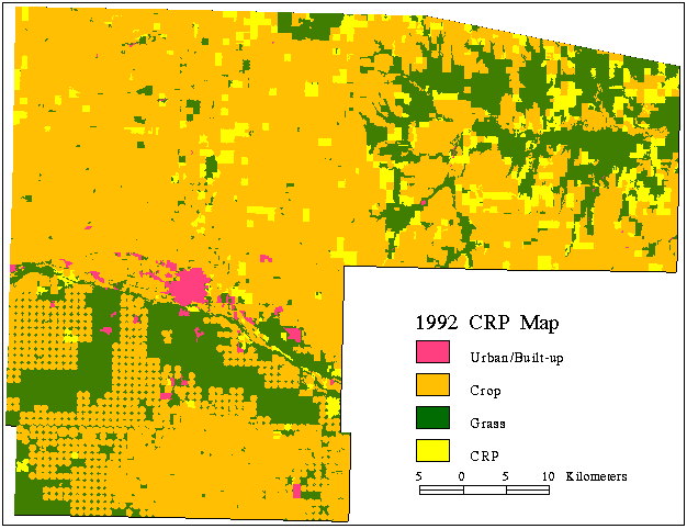
Figure 4. A map of CRP lands that were identified using a combination of multi-date
classification and change detection between the 1987 and 1992 crop and land cover type
maps. (A sliver of the county is missing in the upper right corner because this area was
not covered by the satellite image used for this project.)
Return to article.